Seventy meters, mapped around you
Every ice sheet that can flow into the ocean does. Coasts redraw 70 meters up, and the map centers on the exact place you stand.
Sea Level
Sea Level finds your real elevation from GPS and public data, then draws the coastline if every ice sheet flowed into the ocean. No account, no ads, no analytics.
How it works
The app shows three screens, in the order you need them.
Elevation70-meter gaugeSettings
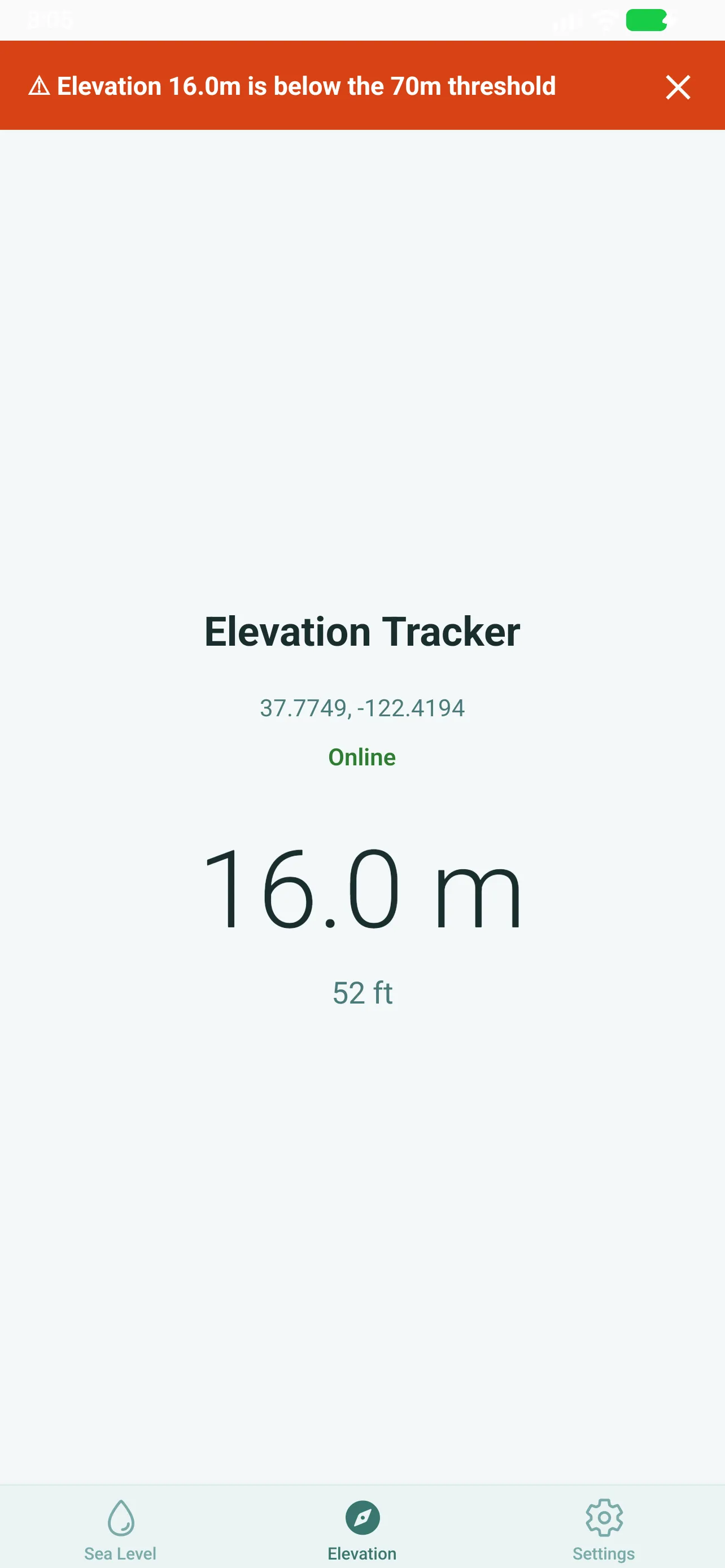
The Elevation tab: one number for the ground under you, computed on the device from GPS, the barometer when the phone has one, and public elevation data, in meters and feet.
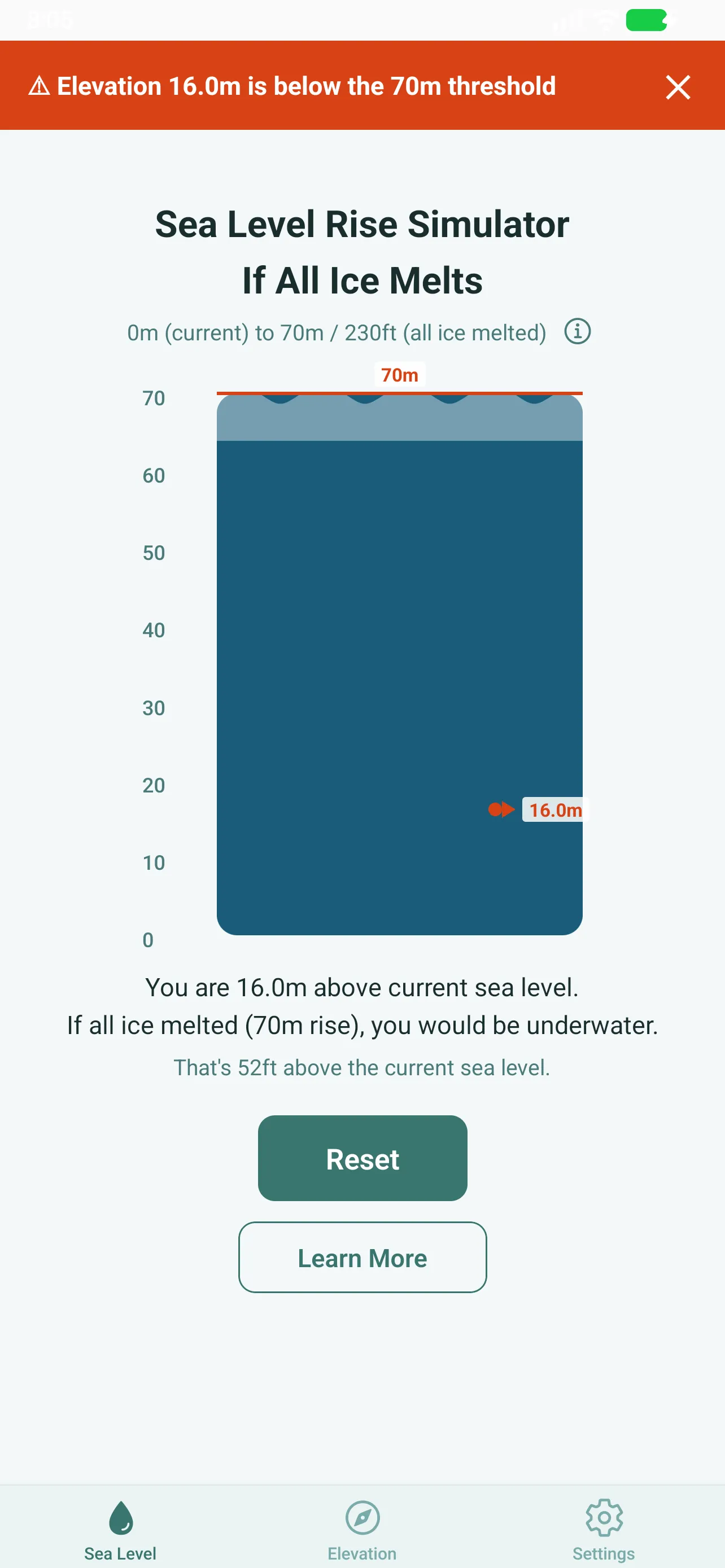
The Sea Level tab: a vertical gauge and a map that redraw the coast 70 meters up, centered on the place you stand.
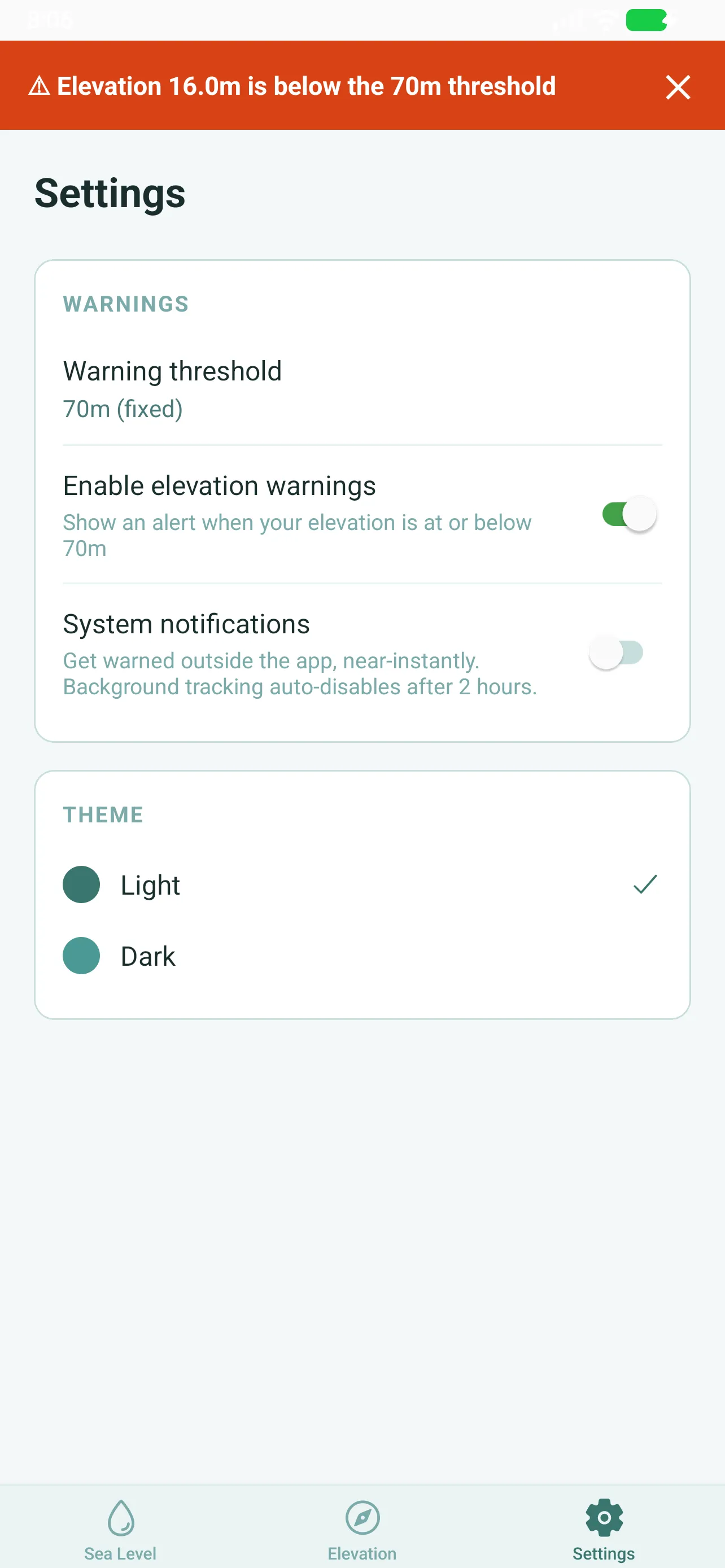
The Settings tab: warning threshold, notifications, units and theme, all reachable without an account and without leaving the app.
Real screenshots from the current build.
What it does
Three things the app does, and nothing else. That is the whole scope.
Every ice sheet that can flow into the ocean does. Coasts redraw 70 meters up, and the map centers on the exact place you stand.
GPS, a barometer when the phone carries one, and public elevation data as the fallback, combined into a single number, shown in meters and feet.
Everything computes on your phone. The only network call is your coordinates to the open elevation service, with no account, no ads and no analytics attached.
About
If every glacier and ice sheet that is not already floating in the ocean melted, the global sea level would rise by about 70 meters. Sea Level maps that world, for where you stand.
From the blog
What the full-melt scenario is, how the number is estimated, and what the map does and does not predict. The assumptions behind Sea Level's headline number, stated plainly.
Elevation, ice, coasts and the maps themselves, newest first. Everything older waits in the archive.
Three absences, stated and designed in: nothing to sign up for, nothing to display, nothing to track. What the app stores, what it sends, and why the privacy is fixed by design instead of by settings.
The global model behind the 70-meter map is computed in meters, most of the world reads them in meters, and the parts that do not still expect feet. How the switch works, and why it never changes the calculation.
The optional elevation-warning feature does background work only while you are near a risky elevation, in sessions that shut themselves down. How the 2-hour sessions are designed, and what happens to the battery.
Sea Level does not guess: it combines GPS, a barometer when the phone has one, and public elevation data as the fallback. How the three sources work, how they rank, and where the meters come from.
A short note when a post lands or the app changes. No tracking pixel, no drip sequence, one click to leave for good.